Every second, about 15 million cubic metres of Pacific Ocean water squeeze through the islands of Indonesia on their way to the Indian Ocean. Oceanographers call it the Indonesian Throughflow. Divers know it as the reason for cold water, ripping currents and big animals. Here is how it works, how scientists measured it, and what it means when you roll off the boat.
What is the Indonesian Throughflow?
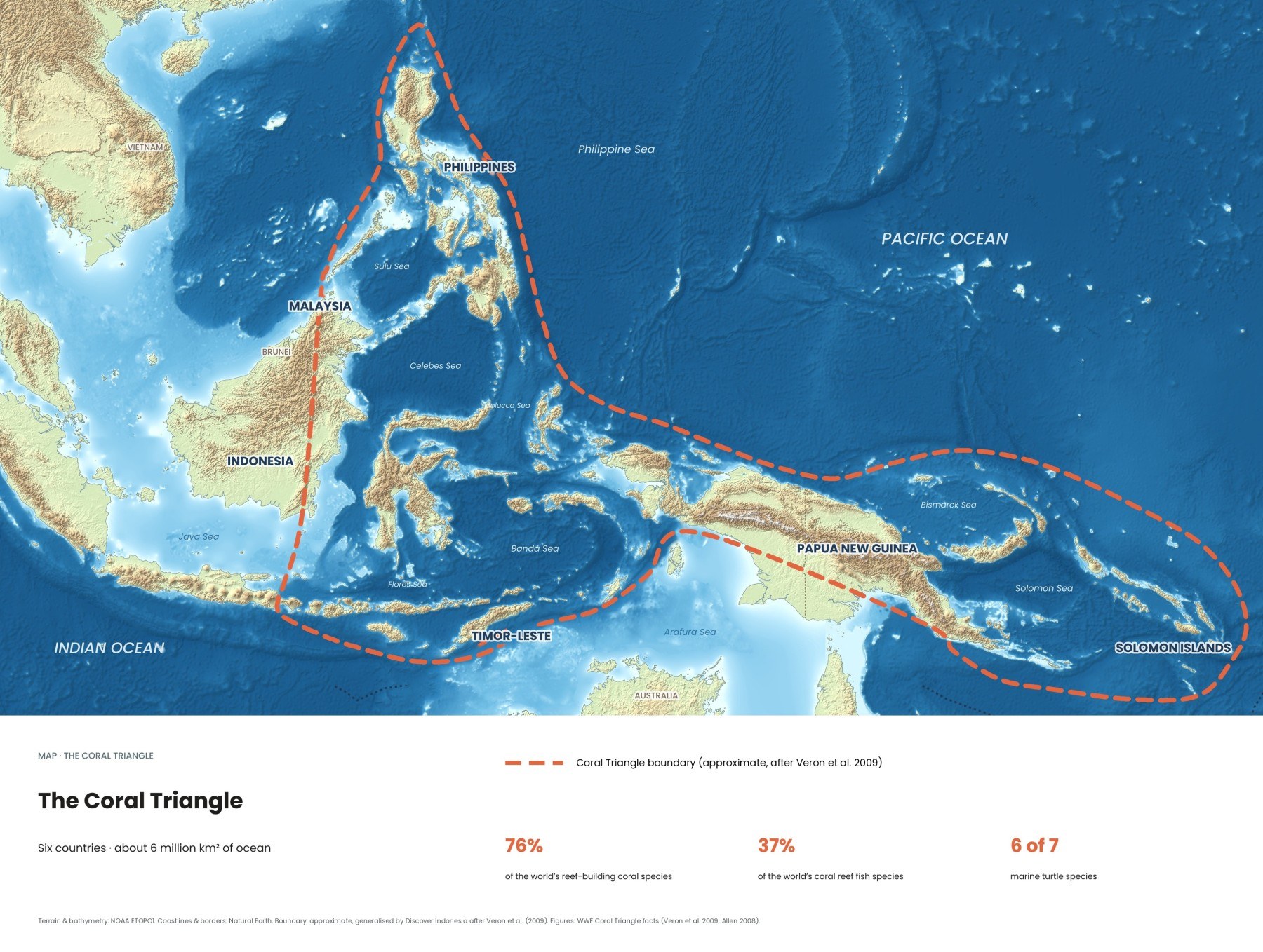
The Indonesian Throughflow is an ocean current that carries warm, relatively fresh water from the western Pacific into the Indian Ocean through the straits between Indonesia's islands. On average about 15 million cubic metres pass every second. It is the only way for water to pass from one ocean to the other in the tropics, and it runs straight through the Coral Triangle.
It flows because the sea surface in the far western Pacific sits slightly higher than in the neighbouring Indian Ocean. The difference is small, but it creates a pressure head that pushes water downhill through the gaps between the islands. Winds, monsoons and waves arriving from both oceans then speed it up or slow it down. Much of it moves in the warm upper layer above the thermocline that matters most for reefs and divers.
What route does the water take through Indonesia?
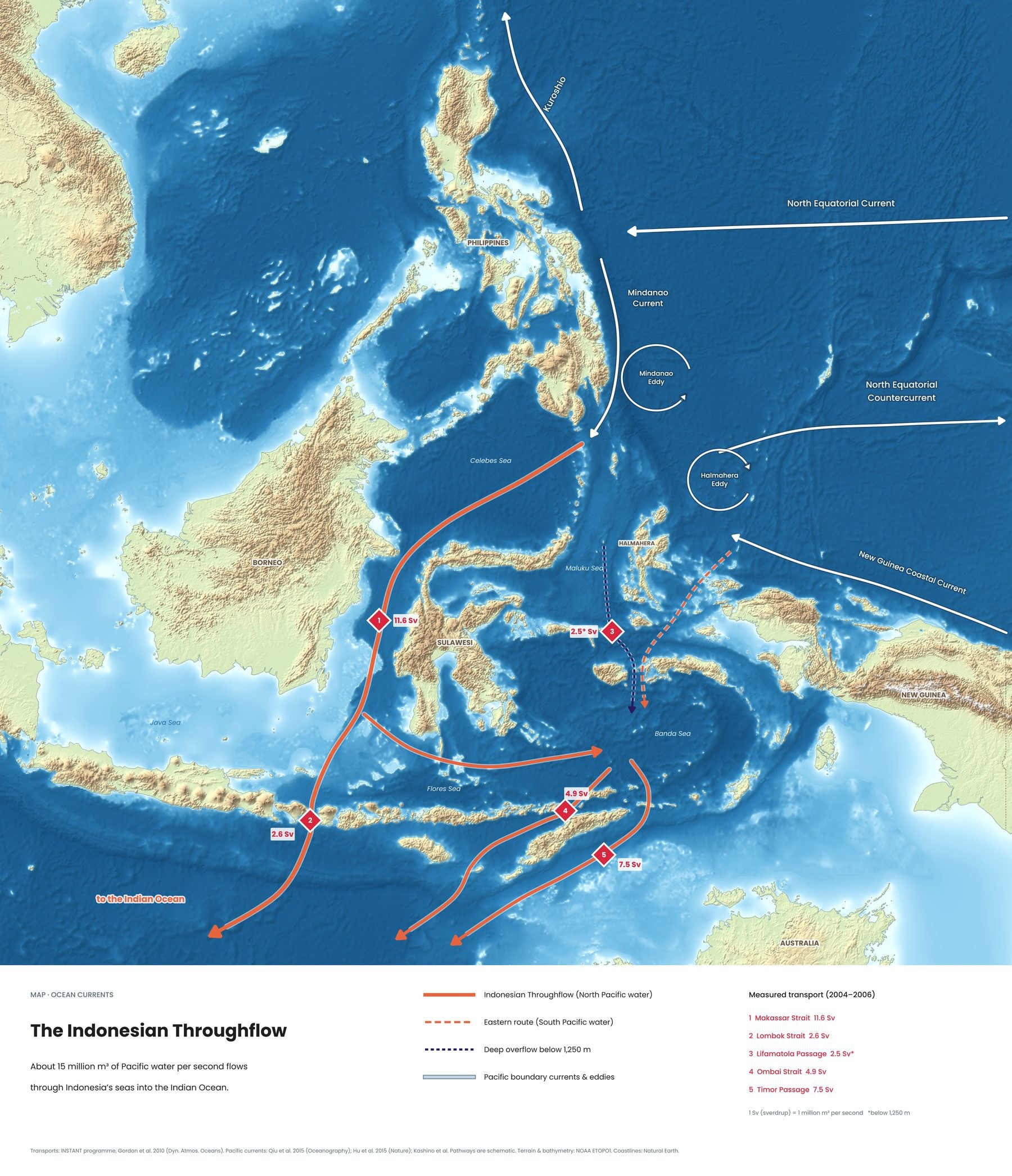
Most of the water enters from the north, carried past the Philippines by the Mindanao Current. The main path runs south through the Makassar Strait between Borneo and Sulawesi, then east through the Flores Sea to the Banda Sea, one of the deepest basins in the world, where it mixes with a smaller, deep inflow of South Pacific water from the Lifamatola Passage. From there it leaves through three exits: the Lombok Strait, the Ombai Strait north of Timor, and the Timor Passage south of it.
| Passage | Where | Average flow |
|---|---|---|
| 1 · Makassar Strait | Between Borneo and Sulawesi. The main highway in. | 11.6 Sv |
| 2 · Lombok Strait | Between Bali and Lombok, past Nusa Penida. The shortest way out. | 2.6 Sv |
| 3 · Lifamatola Passage | East of Sulawesi. Deep South Pacific water into the Banda Sea. | About 1.1 to 2.5 Sv |
| 4 · Ombai Strait | North of Timor, past Alor. | 4.9 Sv |
| 5 · Timor Passage | South of Timor. The widest exit. | 7.5 Sv |
About 15 percent of the outflow takes the shortest route, through the Lombok Strait, about 20 kilometres wide at its southern opening, where a sill of roughly 350 metres near Nusa Penida controls the flow. The rest leaves through the Ombai Strait and the Timor Passage, the widest exit at about 160 kilometres. Together the exits carry about 15 Sv, though over three years the total ranged from about 10.7 to 18.7 Sv.
Does the throughflow change with the seasons and El Niño?
Yes. It is generally strongest during the southeast monsoon, roughly June to August, when steady southeasterly winds push surface water away from the coasts of Java and the Lesser Sunda Islands. It weakens during the northwest monsoon from December to February, and drops to its lowest, around 9 Sv, at the monsoon change in April, when Kelvin waves from the Indian Ocean raise sea level on that side and reduce the height difference that drives the flow.
El Niño tends to weaken it too, by lowering the sea surface on the Pacific side; year-to-year swings of around 3 Sv are linked to these changes. Divers feel the seasons directly: the months of strongest flow are also the months of cold upwelling south of Bali, Lombok and the Lesser Sundas. El Niño years can also bring heat stress to reefs. See how the 2024 heatwave played out across the Coral Triangle →
Why does it matter for the world's climate?
The Indonesian Throughflow is the main upper branch of the global ocean circulation that moves heat and salt between the oceans. It warms the southern Indian Ocean and helps set the position of its warm pools, which influence regional climate. The water is then carried west towards Africa and south in the Agulhas Current, and around South Africa some of it spills into the Atlantic. Pacific heat that passed Nusa Penida can end up some 10,000 kilometres away.
What is upwelling, and where does it happen in Indonesia?
Upwelling is cold, nutrient-rich water rising from the deep towards the surface. In Indonesia it happens mainly during the southeast monsoon, when winds push surface water offshore along the south coasts of Java, Bali and the Lesser Sunda Islands, and deep water rises to replace it. Near the Nusa Penida sill, tidal currents also force water over a ridge and break into large internal waves, which divers may feel as sudden temperature changes and shifting currents.
The nutrients feed plankton, the plankton feeds small fish and manta rays, and the whole food web gets richer. The IUCN's shark and ray experts note deepwater upwelling south of Bali as one reason the waters around Nusa Penida are so productive, and UNESCO describes the seas around Komodo as among the most productive in the world.
Why is the water so cold at Nusa Penida?
Because Nusa Penida sits at the exit of the Lombok Strait, where tidal mixing and seasonal upwelling bring deep water to reef depth. From about July to October, divers regularly meet water of 16 to 22 °C, sometimes after crossing a sharp thermocline from 26 °C to around 20 °C within a few metres.
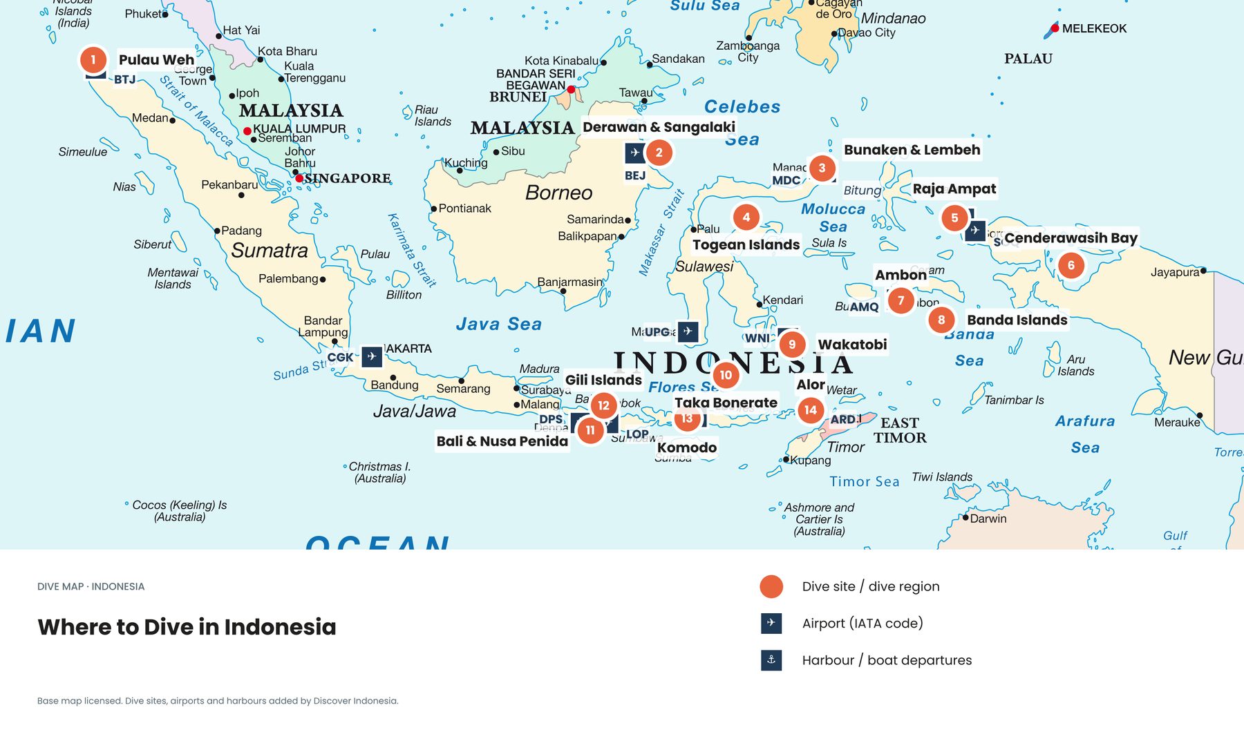
That cold water brings the mola mola up to cleaning stations, usually at 20 to 30 metres. Crystal Bay is the best-known site, and even in season you may need several dives over two or three days to see one. The same water feeds the reef manta rays at Manta Point and Manta Bay; the island is recognised as an Important Shark and Ray Area. Bring a 5 mm wetsuit and a hood in mola season. Our Bali and Nusa Penida dive guide →
Why are the currents so strong at Komodo and Alor?
Komodo National Park sits between the warmer Flores Sea and the cooler Sumba Strait, connected by narrow channels between Komodo, Padar, Rinca and Flores. Tides push water through these gaps, so a site can change character from one hour to the next. The north tends to be warmer and clearer, with schools of fish and reef sharks at Castle Rock and Batu Bolong; the south is colder and greener with plankton, which brings manta rays. Our Komodo dive guide →
Alor lies on the Ombai Strait, carrying about 4.9 Sv towards the Indian Ocean. That brings cold upwellings, very clear water and healthy reefs, along with strong currents. In the Pantar Strait the water can turn noticeably colder within a single dive, and the mid-strait pinnacles are dived only on the right tide with experienced local operators. Our Alor dive guide →
How do you dive safely in throughflow currents?
Dive with local guides who plan around the tides, because the same site can be gentle at one hour and dangerous the next. Carry a surface marker buoy on every drift dive and know how to deploy it from depth. Build up your current experience on easier sites first; Toyapakeh and Blue Corner off Nusa Penida are for experienced divers with a local guide. Expect sudden temperature drops and down-currents: if you are pulled down, move away from the wall towards open water or the shallows, as your guide briefed, and turn a dive if conditions look wrong.
Quick answers
How was the throughflow measured?
Between 2004 and 2006, the international INSTANT programme anchored 11 moorings with current meters in the main inflow and outflow channels, measuring all of them over the same three years.
What is a Sverdrup?
A million cubic metres of water per second. The throughflow's 15 Sv would fill an Olympic swimming pool about 6,000 times every second.
Does the throughflow make the Coral Triangle richer?
It is one of several reasons. It carries larvae and nutrients between reefs, and its upwellings support productive feeding grounds; warm water, thousands of islands and many habitats do the rest.
Read more: all eight Coral Triangle maps and how the Coral Triangle compares with the Great Barrier Reef. Our Coral Triangle and diving guides cover planning in more depth; see all our guides.
Facts checked October 2026. The flow figures are multi-year averages from the INSTANT programme; actual currents change with tides, seasons and El Niño, so always rely on local dive operators for conditions on the day.
- The Indonesian throughflow during 2004–2006 as observed by the INSTANT program (Gordon et al. 2010, Dynamics of Atmospheres and Oceans)
- Direct estimates of the Indonesian Throughflow entering the Indian Ocean: 2004–2006 (Sprintall et al. 2009, Journal of Geophysical Research)
- Indonesian Throughflow (Wikipedia)
- Lombok Strait (Wikipedia)
- Komodo National Park (UNESCO World Heritage Centre)
- Nusa Penida ISRA factsheet (IUCN SSC Shark Specialist Group)
- Mola mola in Bali (Nusapenida.org)
- Map: terrain and bathymetry NOAA ETOPO1; coastlines Natural Earth; Pacific boundary currents after Qiu et al. 2015 and Hu et al. 2015