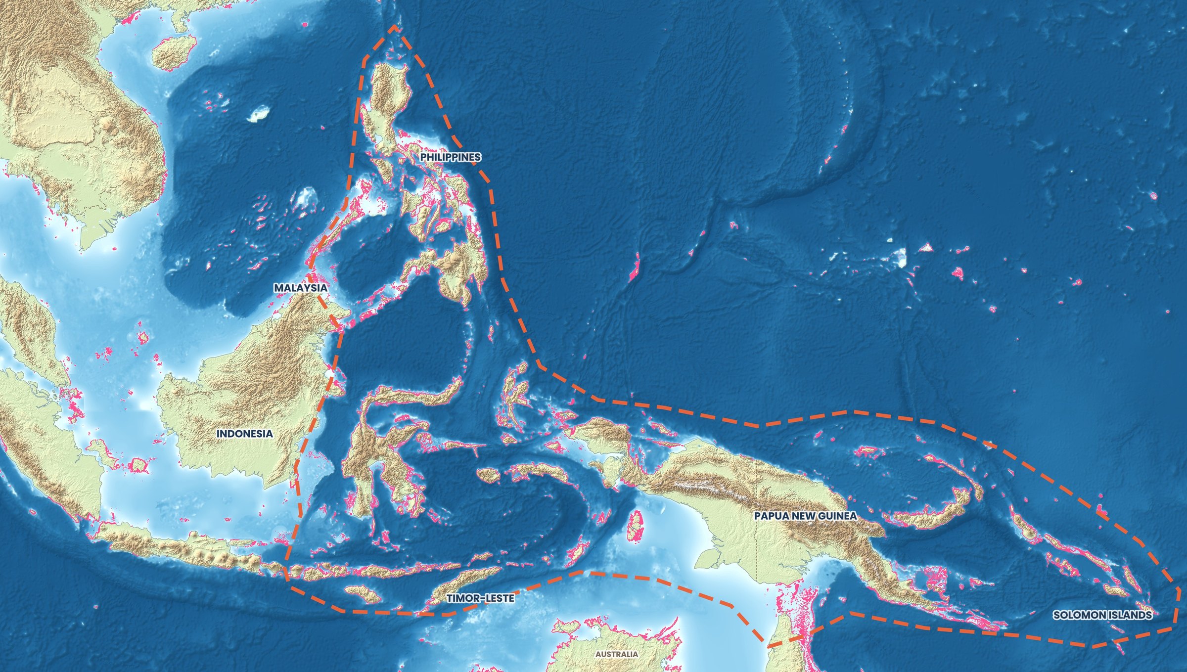
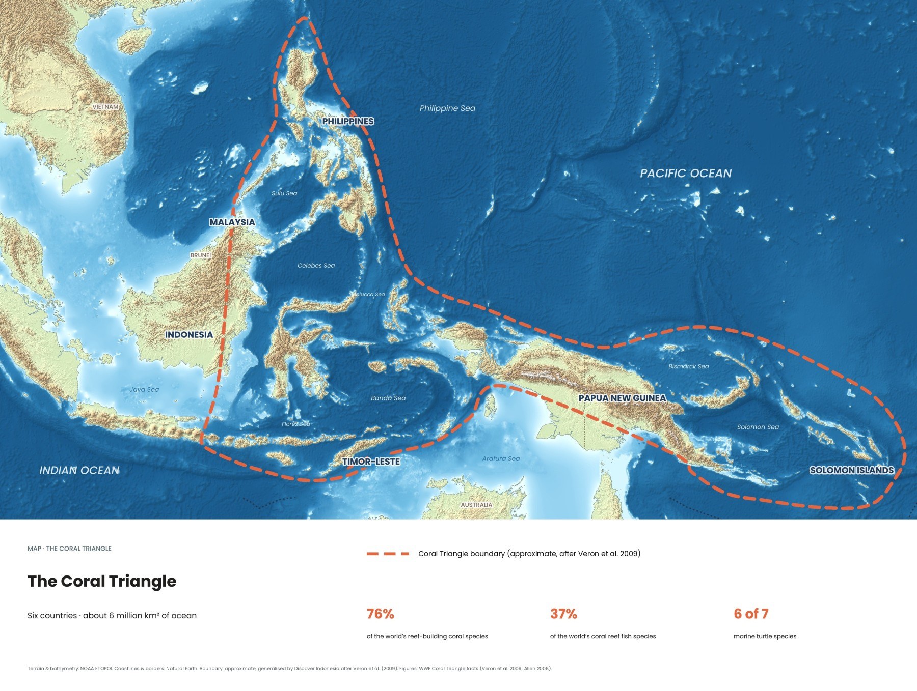
The Coral Triangle covers six million square kilometres of sea, and Indonesia holds the largest part of it. These are ten places where its richness is easiest to experience, with how to get there, when to go and what level of diver each one suits.
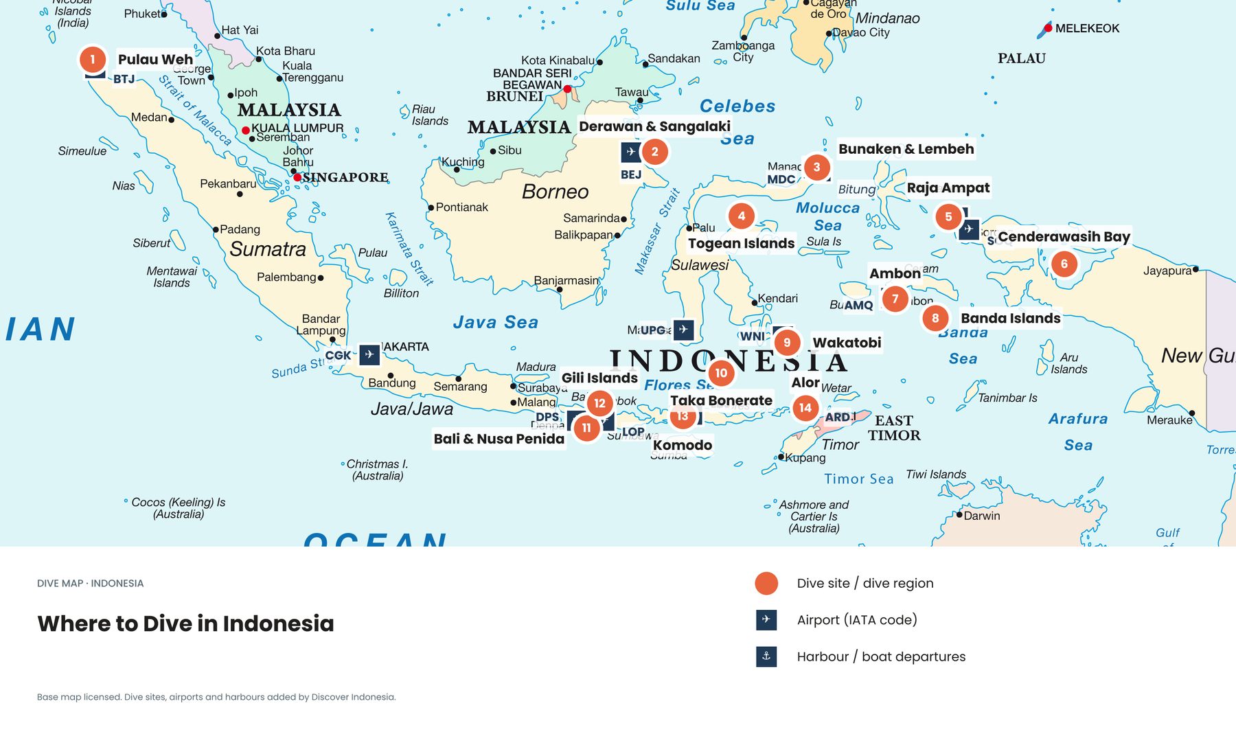
Where is the best place to see the Coral Triangle?
Raja Ampat in West Papua is the classic answer: it holds the highest reef fish counts ever recorded on a single dive. If you have less time, Nusa Penida is a 45-minute boat ride from Bali, and Komodo is a short flight away. Wakatobi and North Sulawesi sit in between for effort and reward. The choice comes down to how many days you have, how comfortable you are in current, and what you want to see.
| Place | Gateway | Best known for | Level |
|---|---|---|---|
| Raja Ampat | Sorong, then ferry to Waisai | Fish diversity, mantas | All levels, some strong currents |
| Komodo | Labuan Bajo | Currents, mantas, big fish | Advanced for the famous sites |
| Wakatobi | Wangi-Wangi (Matahora) | Healthy reefs, walls | All levels |
| North Sulawesi | Manado | Walls and muck diving | All levels |
| Nusa Penida | Sanur, Bali | Mantas, mola mola | Advanced for drift and mola sites |
| Alor | Kupang, then Alor | Clear, cold water | Experienced |
| Banda Islands | Ambon | Walls, history | Intermediate |
| Cenderawasih Bay | Nabire | Whale sharks | All levels |
| Taka Bonerate | Selayar | Remote atoll | All levels, self-reliant |
| Togean Islands | Ampana or Gorontalo | Calm reefs, slow travel | Snorkellers and beginners |
Raja Ampat, West Papua
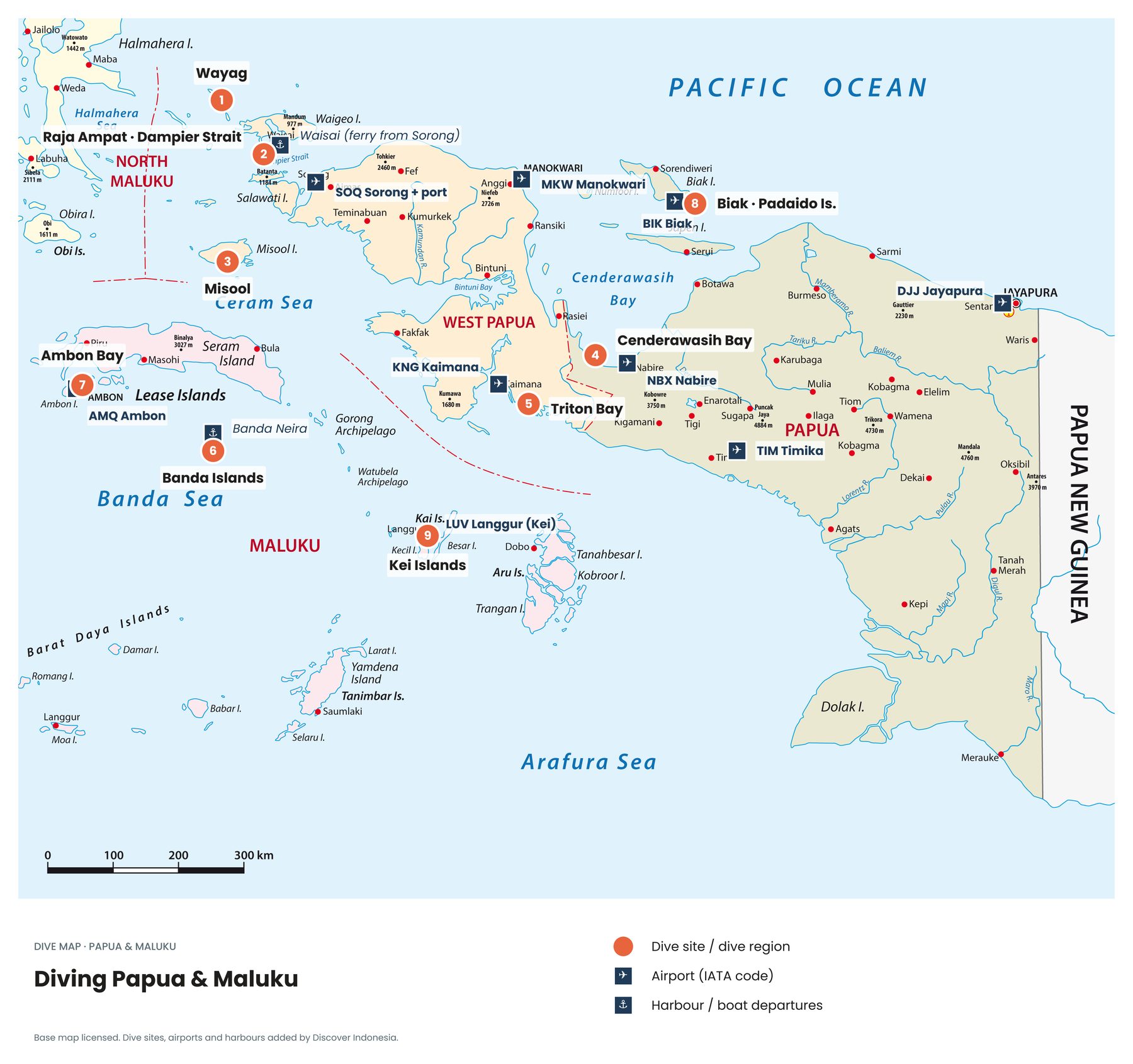
The heart of the Coral Triangle. At Cape Kri, ichthyologist Gerald Allen counted 374 fish species in a single 90-minute dive, the highest count of his career, and WWF counts 553 coral species here. Most famous sites are packed into the Dampier Strait between Waigeo and Batanta, where currents feed huge schools of fish, reef sharks and manta rays. Further south, Misool adds soft-coral walls and quiet lagoons. UNESCO added Raja Ampat to its network of biosphere reserves in 2025.
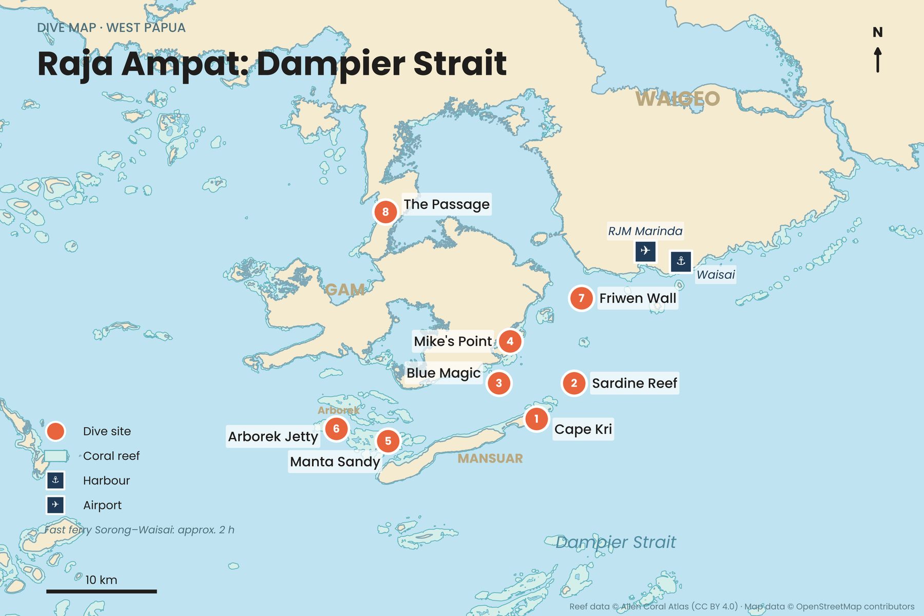
Fly to Sorong, then take the ferry of about two hours to Waisai; liveaboards board in Sorong. The usual season is October to April, when the sea is calmer. Sheltered bays suit beginners and snorkellers, while the strait's current points need drift experience. Every visitor pays the environmental service fee, raised for foreigners in 2026, so confirm the amount before travelling and keep your tag on you. Raja Ampat dive guide →
Komodo and Alor
In Komodo, strong tidal currents sweep through the channels between Komodo, Rinca and Flores, bringing nutrients, big fish and manta rays. Castle Rock, Crystal Rock and Batu Bolong are among the most exciting dives in Indonesia, and on land the dragons wait. Fly to Labuan Bajo, about 1 hour 15 minutes from Bali. It is diveable all year: April to June brings calm seas and the best visibility, July to September the strongest currents and southern water around 20 to 24°C. The famous sites need solid drift experience; do not do your first open-water dive here.
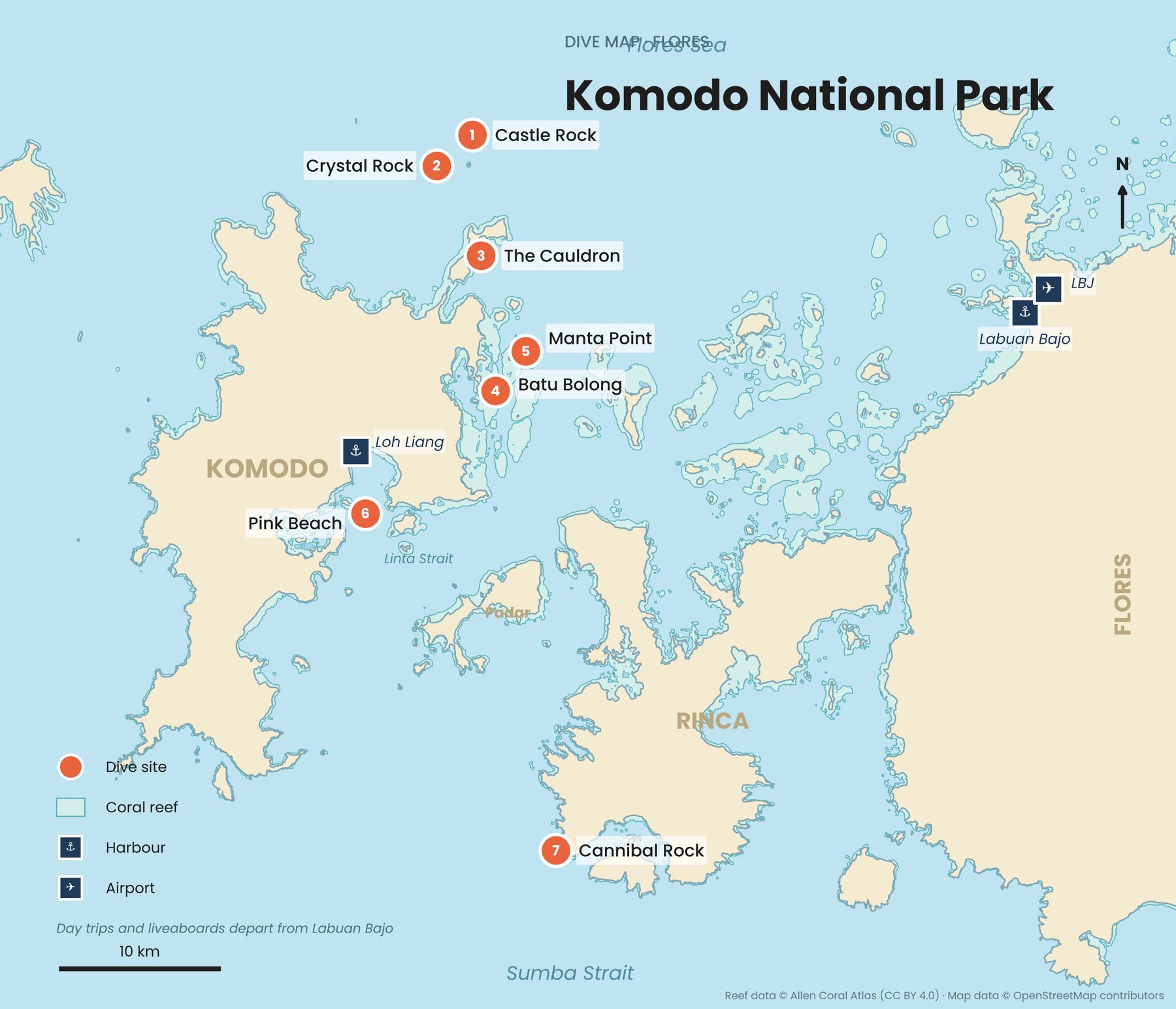
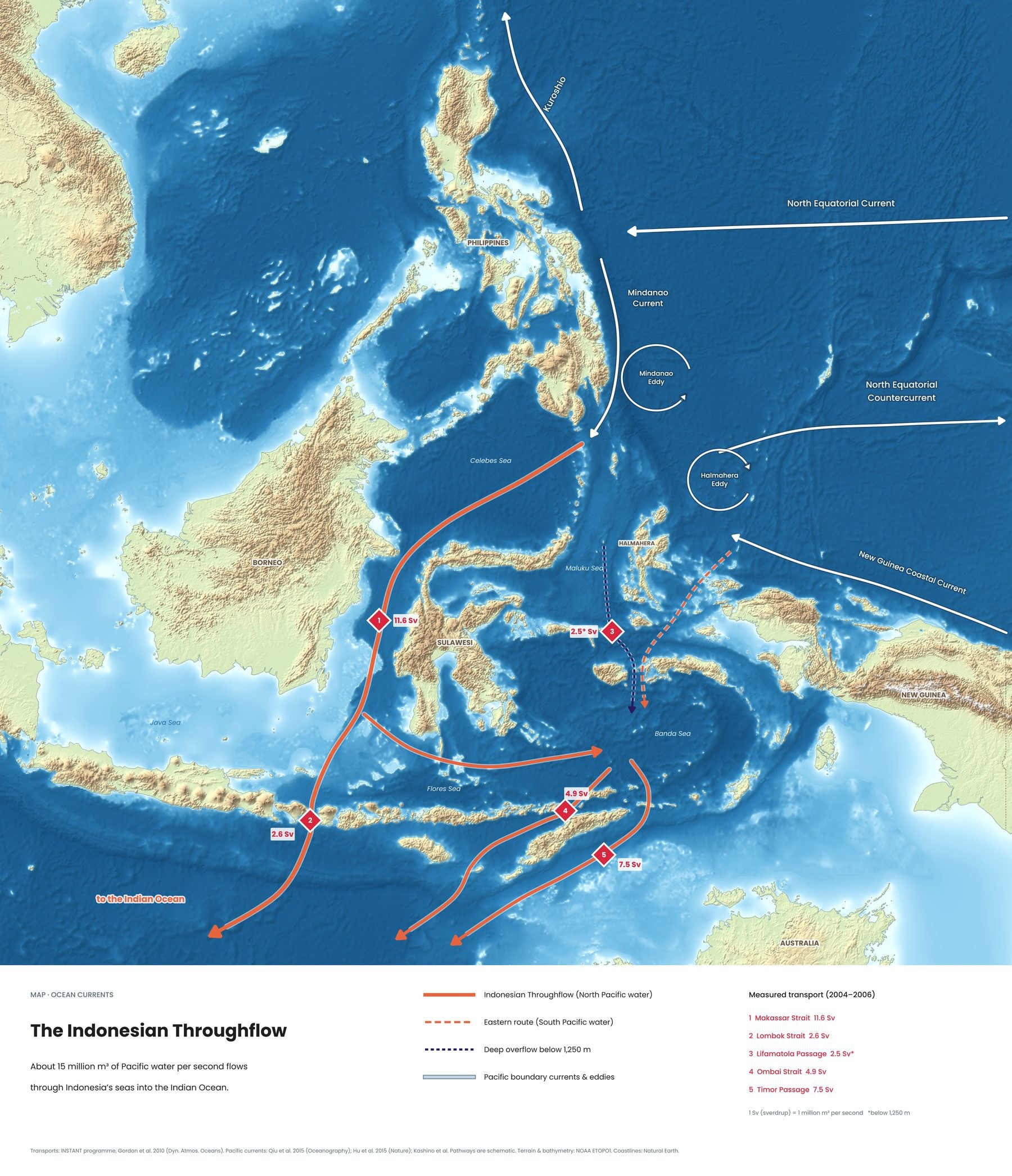
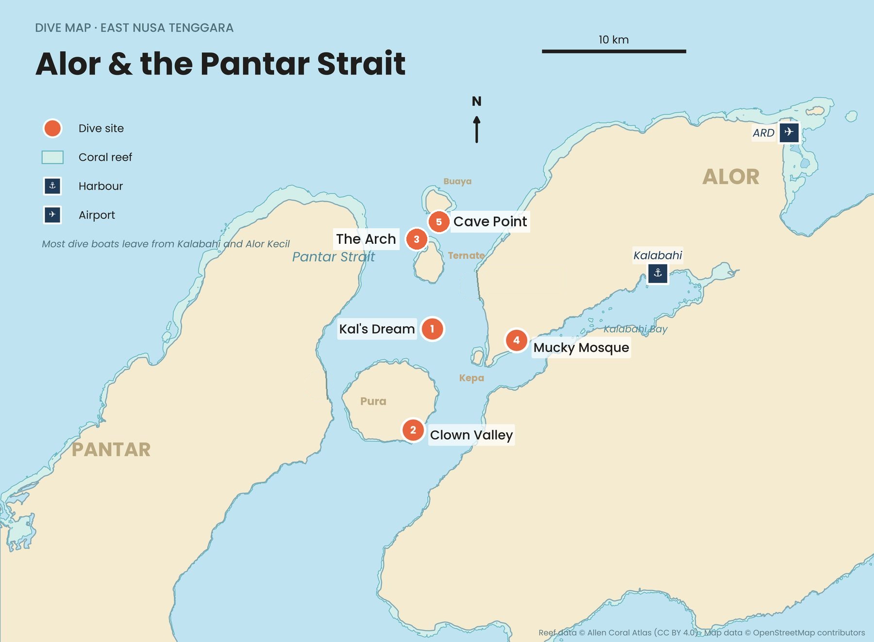
Further east, the channels around Alor carry water towards the Ombai Strait, one of the main throughflow exits, giving some of the healthiest coral in the region and very clear water. Routes go through Kupang, and many divers arrive on liveaboards. It is for experienced divers: currents are serious and the water can turn noticeably colder within a dive. Komodo dive guide → · Alor dive guide →
Nusa Penida, Bali
The easiest way into the Coral Triangle. Nusa Penida sits beside the Lombok Strait, the throughflow's shortest exit to the Indian Ocean. Reef manta rays visit Manta Point all year, and from about July to October the mola mola rises from the cold deep to be cleaned on the reef, with August often the best month and Crystal Bay the most reliable site. Fast boats from Sanur take about 35 to 45 minutes, so a day trip from Bali is possible.
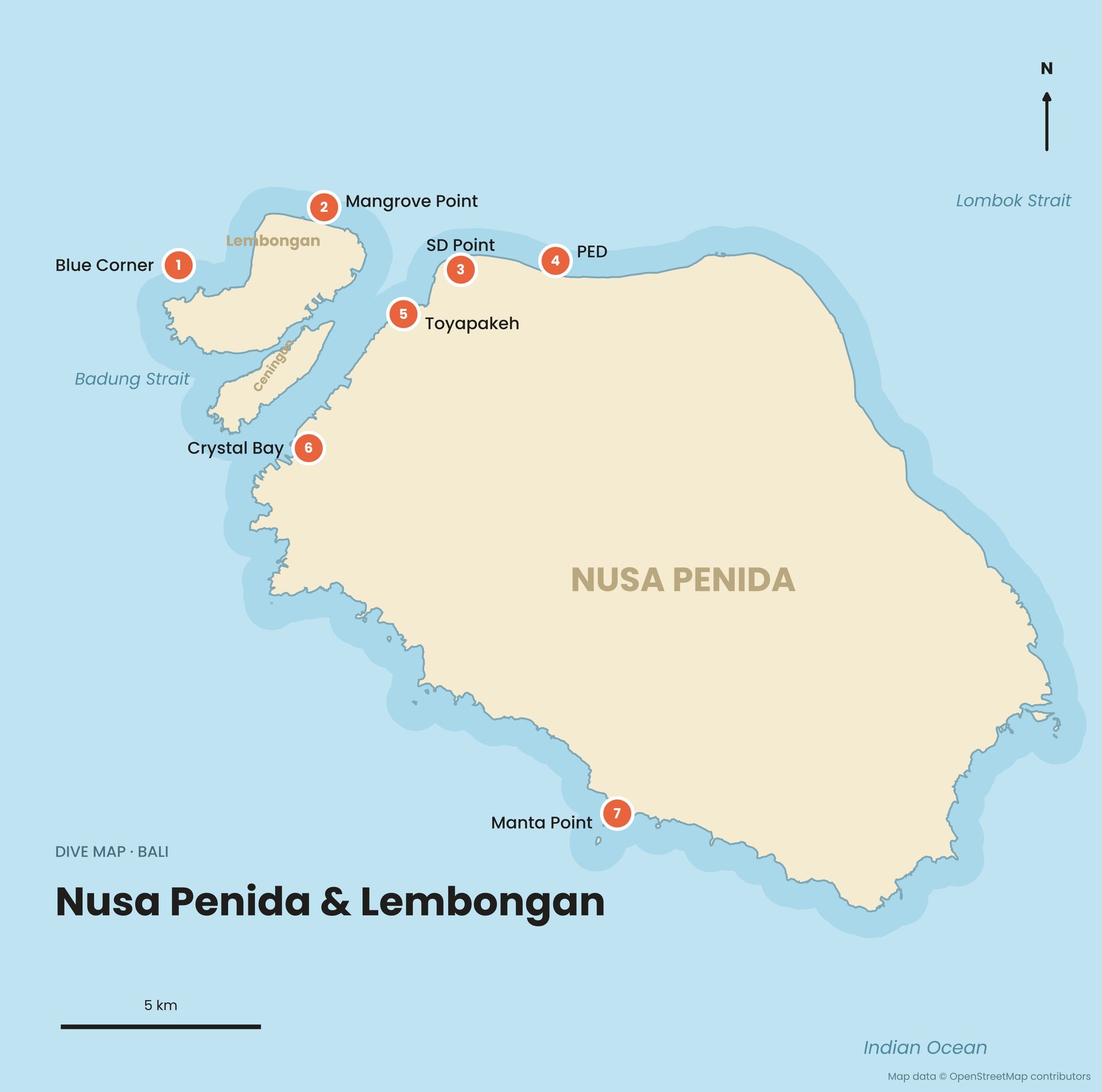
Advanced Open Water and logged current dives are a sensible minimum for the mola and drift sites. Currents are strong, can change quickly and include down-currents. Pack a 5 mm wetsuit: deep water in mola season can drop below 20°C. Bali dive guide →
Wakatobi and Taka Bonerate
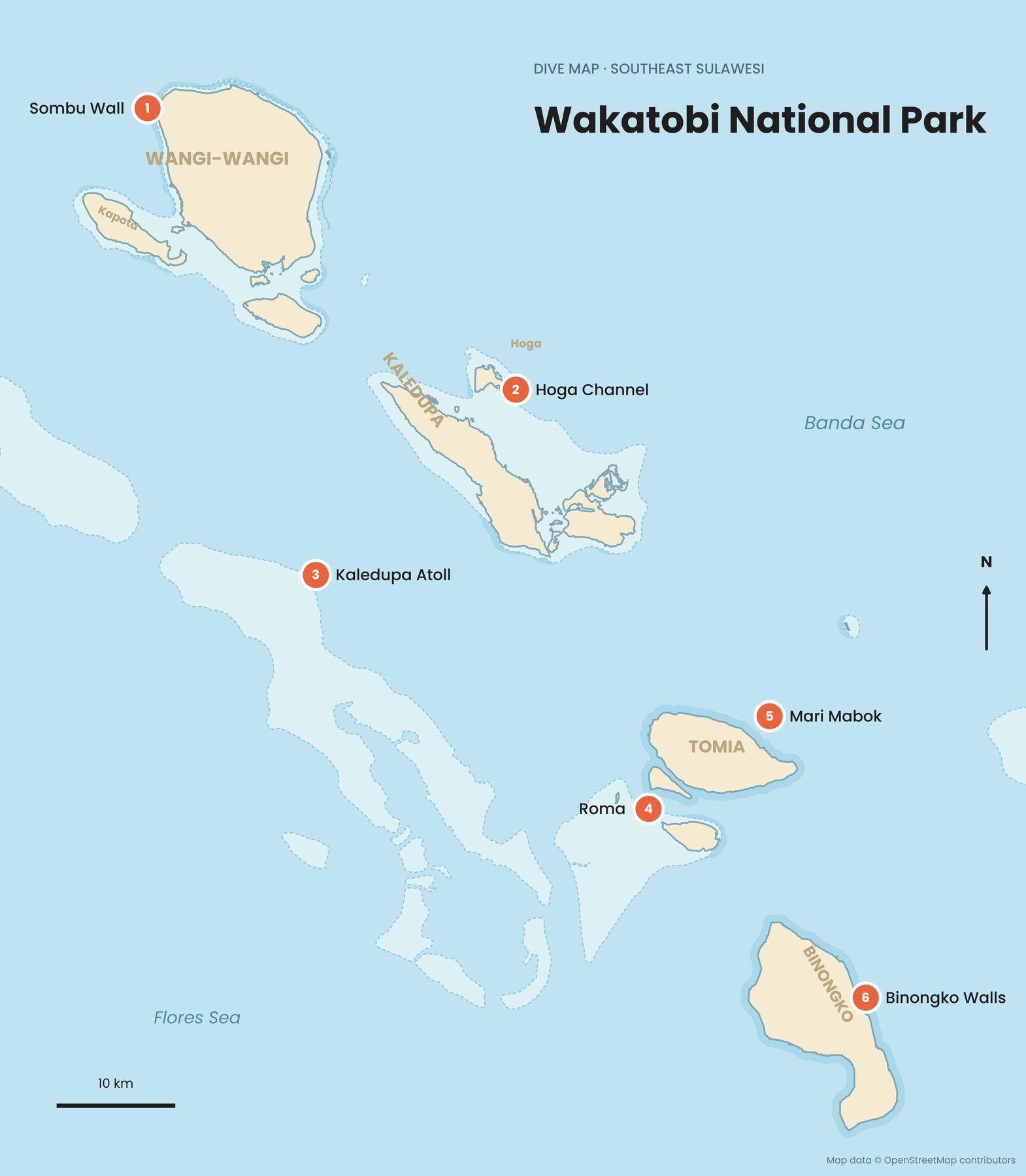
Wakatobi is the Coral Triangle at its calmest, with healthy walls, clear water and gentle conditions. Surveys have recorded 396 coral species and 942 fish species, and UNESCO named it a biosphere reserve in 2012. Fly to Matahora on Wangi-Wangi via Makassar or Kendari. Walls start shallow, which makes it one of Indonesia's best places for snorkellers too, and Bajau stilt villages are part of daily life. Wakatobi dive guide →
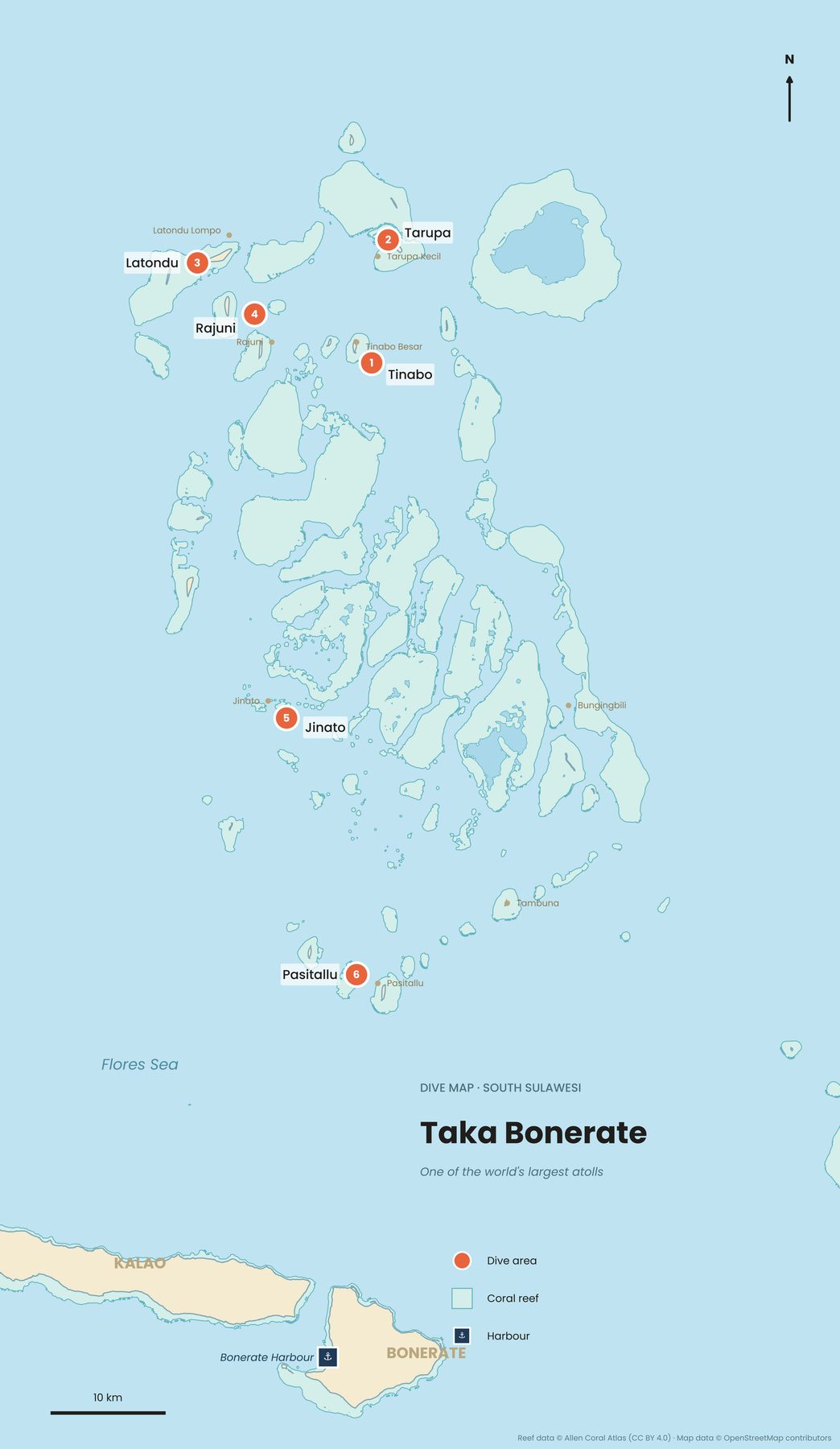
Taka Bonerate in the Flores Sea is the third-largest atoll in the world and the largest in Southeast Asia. Few divers make it here, which is the appeal. Reach Selayar from Makassar, then take a rented boat of about four hours to Tinabo. Facilities are basic, so bring your own gear. Taka Bonerate dive guide →
North Sulawesi and the Togean Islands
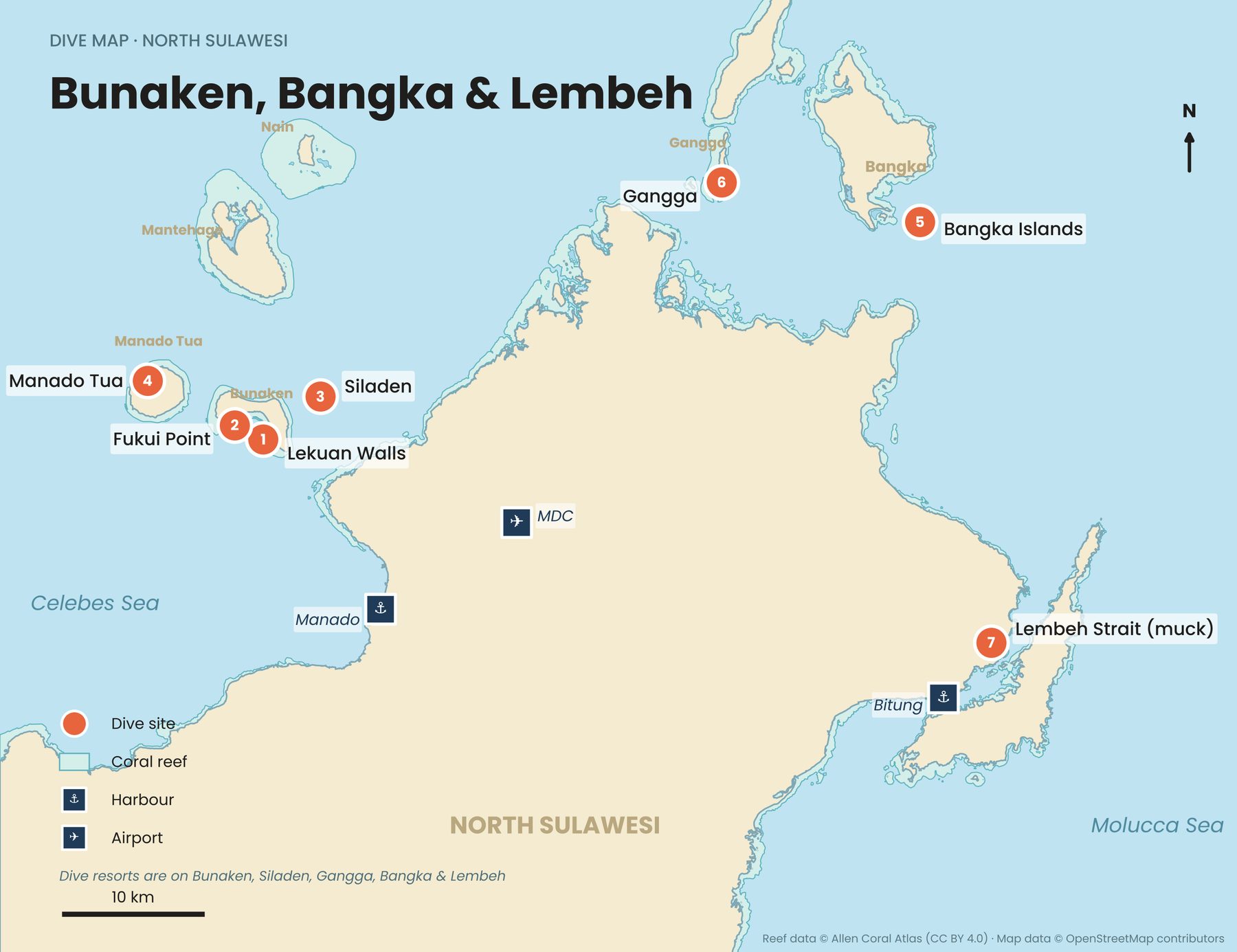
Two very different worlds sit on either side of the same peninsula. Off Manado, the walls of Bunaken National Park drop into the deep just offshore, with turtles, reef fish and around 390 coral species. Across the peninsula, the black sand of the Lembeh Strait is the capital of muck diving, home to frogfish, octopus and nudibranchs. Fly to Manado; both suit all levels, and a week split between them works well. North Sulawesi dive guide →
In the calm Gulf of Tomini, the Togean Islands combine coral reefs, mangroves and non-venomous jellyfish. Wooden bungalows, slow days and some of the gentlest snorkelling in Indonesia make them a good place to learn to dive. Reach Ampana or Gorontalo, then take a ferry or speedboat to Wakai; public ferries run only about twice a week. All of Sulawesi's dive regions on one map →
The Banda Islands and Cenderawasih Bay
Until the mid-19th century, the tiny Banda Islands were the world's only source of nutmeg and mace. Across from Banda Neira stands Gunung Api, the volcano that erupted in May 1988, and divers explore the coral that has grown back over its young lava, as well as steep walls with schooling fish. Flights and boats from Ambon change often and get cancelled in rough weather, so allow spare days; many divers visit on a Banda Sea liveaboard.
Cenderawasih Bay, Indonesia's largest marine national park, is famous for whale sharks, which gather around the fishing platforms called bagan. They are often near the surface, so snorkellers can join. Do not touch them, and follow your guide's rules on distance. Papua and Maluku dive guide →
Where else can you see the Coral Triangle outside Indonesia?
The best-known highlights are Tubbataha in the Philippines, Sipadan in Malaysia, Kimbe Bay in Papua New Guinea and the Solomon Islands. Tubbataha Reefs can only be visited by liveaboard from Puerto Princesa, from mid-March to mid-June. Sipadan, off Sabah, rises about 600 metres from the seabed, and Sabah Parks issues a limited number of dive permits each day. Kimbe Bay has more than 860 reef fish species, and the Solomon Islands add remote reefs and Second World War wrecks.
Quick answers
Is Bali in the Coral Triangle?
Bali sits on its western edge. Nusa Penida and the reefs of east and north Bali fall inside it, which makes Bali the easiest entry point for most travellers.
Can I see the Coral Triangle without diving?
Yes. Raja Ampat, Wakatobi, the Togean Islands and Nusa Penida all have excellent snorkelling. Avoid snorkelling alone in current-swept channels, especially around Komodo and Nusa Penida.
How long do I need for a Coral Triangle trip?
With a few days, stay on Nusa Lembongan or Nusa Penida; with a week, add Komodo. For a far-east region, give it at least seven nights, because the travel days eat into short trips.
What should I sort out before I go?
Dive insurance, because hyperbaric chambers are few and far apart in eastern Indonesia, enough cash for park fees, and buffer days for flights and boats.
To understand what you are looking at, read the Coral Triangle explained in eight maps. Our diving, Coral Triangle, Raja Ampat and Wakatobi guides cover routes and planning in more depth; see them all on our guides page.
Facts checked October 2026. Park fees, ferry and flight schedules change often, especially in Raja Ampat, Komodo and the Banda Islands; confirm with the national park office, the regency or your dive operator before booking.
- One fish, two fish, 374 fish (Scuba Diving)
- Dr Gerry Allen lives to dive and count fish (Bird's Head Seascape)
- Raja Ampat: the global epicentre of marine biodiversity (Reef Life Survey)
- Raja Ampat travel inspiration (Wonderful Indonesia, Ministry of Tourism)
- Raja Ampat entry fees and registration 2026 (Ocean Earth Travels)
- Coral Triangle facts (WWF)
- Komodo National Park (UNESCO World Heritage Centre)
- Best time of year to dive Komodo (Dive Tribe Komodo)
- Komodo island diving (Komodo Resort)
- 7 things to know about Wakatobi (Wonderful Indonesia, Ministry of Tourism)
- Wakatobi National Park (Wikipedia)
- Bunaken National Park (Wikipedia)
- Nusa Penida diving guide (nusapenida.org)
- Mola mola diving season in Bali (Ocean Earth Travels)
- Alor Island (Wikipedia)
- Banda Islands and Banda Api (Wikipedia)
- Teluk Cenderawasih National Park (Wikipedia)
- Taka Bonerate National Park (Wikipedia)
- Togean Islands (Wikipedia)
- Tubbataha Reef, Sipadan and Kimbe Bay (Wikipedia)