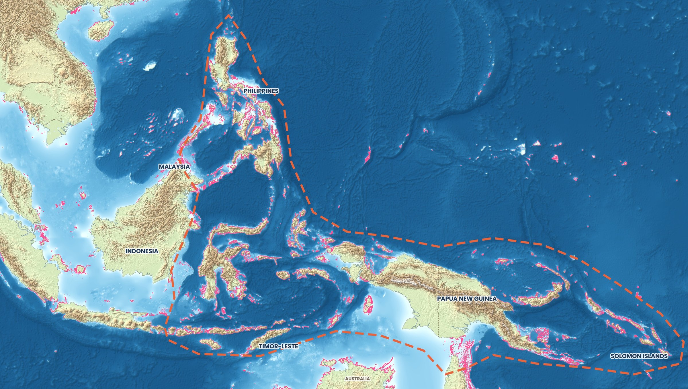
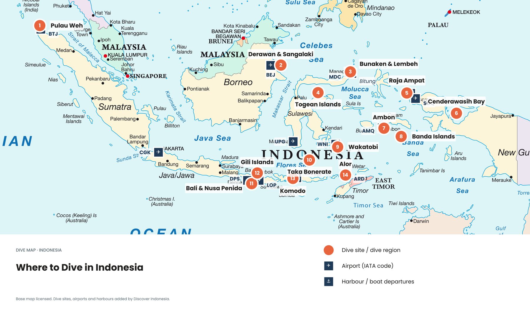
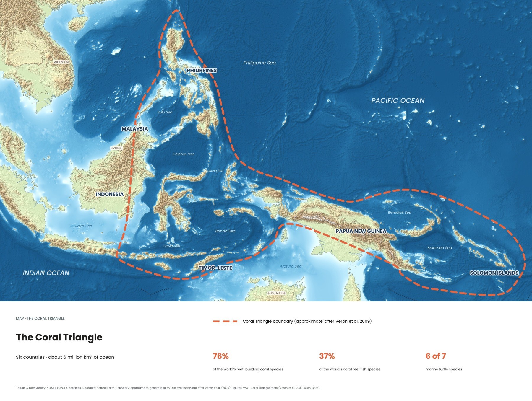
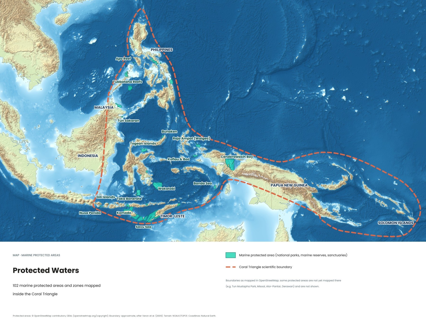
Some of the world's best dive sites are also some of its best-protected waters. This map shows 102 marine protected areas and zones mapped inside the Coral Triangle. Here is how Indonesia's marine parks work, how much of its sea is protected today, and what your park fee actually pays for.
How much of Indonesia's sea is protected?
About 9 percent. In 2025 Indonesia's marine conservation areas covered roughly 29.9 million hectares, according to figures reported by Mongabay Indonesia. The government's goal is 97.5 million hectares, or 30 percent of its sea, by 2045, staged through 32.5 million hectares over 2025 to 2029, 56.8 million in the early 2030s and 81.3 million in the late 2030s.
Not all of that area is protected to the same standard. When Fisheries Minister Sakti Wahyu Trenggono set out the target in February 2024, the total of 28.9 million hectares was split into 21.5 million hectares already designated and 7.4 million reserved for future designation. A line on the map is only the start: a park needs a zoning plan, a management unit, patrols and funding before it protects anything.
Who manages Indonesia's marine parks?
Two systems run side by side. The oldest marine national parks, including Komodo, Bunaken, Wakatobi, Taka Bonerate and Cenderawasih Bay, are run by national park offices (Balai Taman Nasional). Most newer marine conservation areas are created by the fisheries ministry or provincial governments, often with strong local involvement. On the water you will rarely notice the difference, except in the fees. Inside most parks, zoning decides what is allowed where: core zones with no access, no-take zones where diving is fine but fishing is not, and traditional zones where local communities keep fishing.
The marine national parks divers know
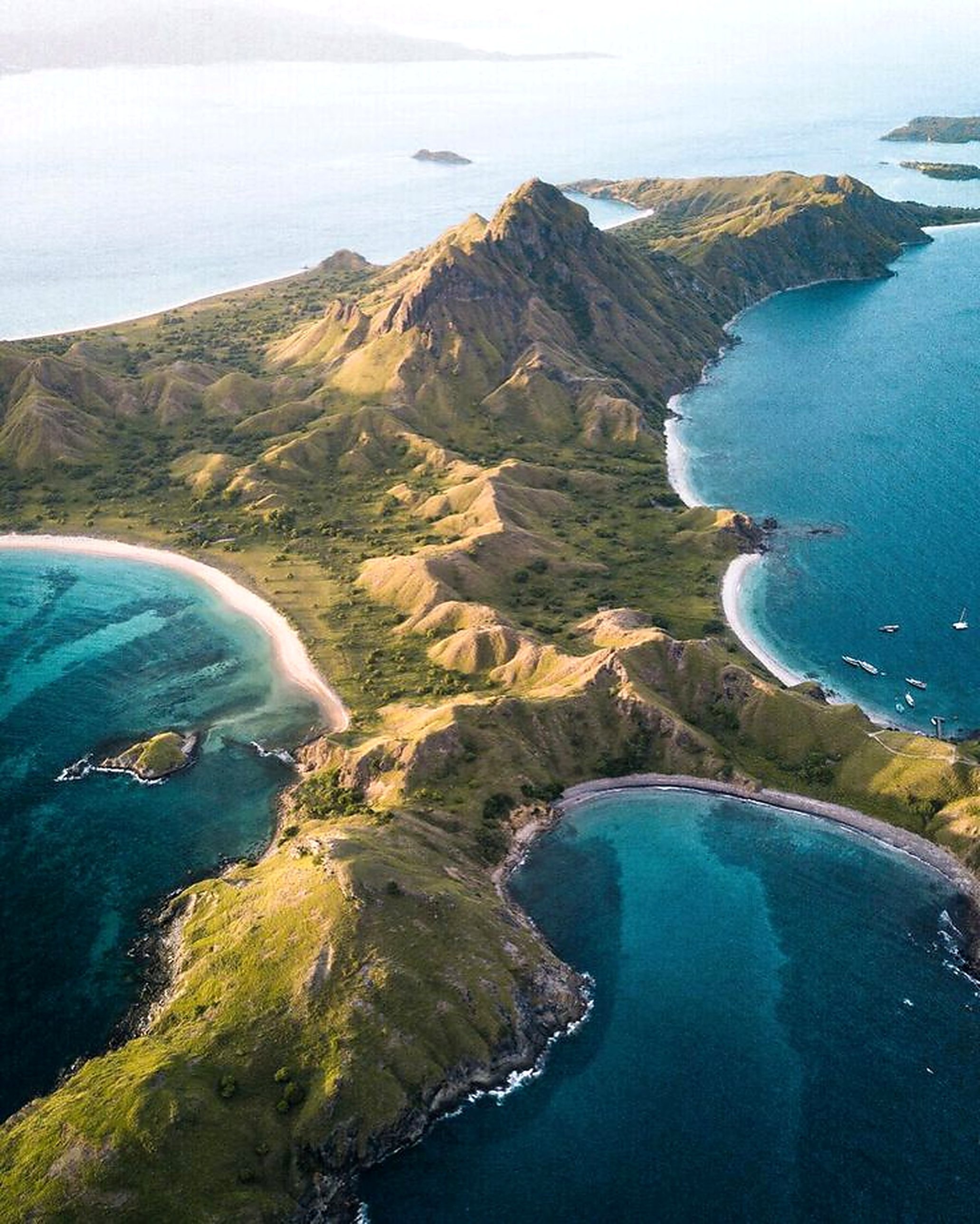
Komodo National Park, East Nusa Tenggara. Declared in 1980 and enlarged in 1984 to 219,322 hectares, much of it sea, Komodo became a UNESCO World Heritage Site in 1991. Mantas, reef sharks and thick schools of fish draw divers, and strong currents shape every dive plan. The park recorded 429,509 visitors in 2025, more than its own carrying-capacity study allowed for, and since 1 April 2026 it has capped visits at 1,000 people per day, booked through the park's online SiOra system. Read our Komodo dive guide.
Bunaken National Park, North Sulawesi. Formally established in 1991, Bunaken covers about 890 square kilometres, around 97 percent of it sea, with five islands and stretches of coast near Manado. Its vertical coral walls start just metres from the shore, and entrance fees are handled by the park's Management Advisory Board, so tourism money goes straight back into the park. North Sulawesi dive guide.
Wakatobi National Park, Southeast Sulawesi. Declared in 1996 and covering 1.39 million hectares, Wakatobi became a UNESCO Biosphere Reserve in 2012. Surveys have recorded 942 fish species. It is also home to Bajau sea communities whose livelihoods depend on the same reefs, which makes fair zoning as much a social question as an ecological one. Wakatobi dive guide.
Taka Bonerate and Cenderawasih Bay. Taka Bonerate in the Flores Sea, established in 1992, is usually ranked the third-largest atoll in the world, and few divers make it this far. Taka Bonerate dive guide. At 1,453,500 hectares, Cenderawasih Bay in Papua is Indonesia's largest marine national park, and its whale sharks, gathering around the floating fishing platforms called bagan, are the reason most visitors come.
How is Raja Ampat protected?
Mainly by a network of seven marine protected areas run with the regency and local communities, including Dampier Strait, Misool, Kofiau-Boo, Mayalibit Bay and West Waigeo, covering well over a million hectares. Every visitor needs a marine park entry card, valid for 12 months, and must carry proof of it because patrols check. Use mooring buoys, never anchor on reef, don't touch coral or feed animals, and keep at least 3 metres from manta rays.
The threats are not only on the reef. In June 2025 the government revoked the licences of four of the five nickel mining companies working in Raja Ampat, after Greenpeace Indonesia said mining had destroyed more than 500 hectares of forest and vegetation on Gag, Kawe and Manuran islands. PT Gag Nikel was allowed to continue under close monitoring. Raja Ampat dive guide.
Other protected areas on the map
- Togean Islands, Central Sulawesi: quiet islands in the calm Gulf of Tomini, hard to reach and lightly visited.
- Banda Sea and Savu Sea: large marine conservation areas across the deep seas of eastern Indonesia.
- Gili Islands and Nusa Penida: smaller regional conservation areas around some of Indonesia's busiest dive sites.
- Tubbataha Reefs and Apo Reef, Philippines: two of the Philippines' best-known protected reefs.
The map shows protected areas as recorded in OpenStreetMap. Some parks, such as Misool in Raja Ampat, Alor-Pantar, Derawan and Malaysia's Tun Mustapha Park, aren't mapped there yet and are missing from the map.
Do marine protected areas actually work?
When they are enforced, yes. In well-run no-take zones, fish grow bigger and more numerous, and the surplus spills over into surrounding waters where local fishers can catch them. The weak point is the gap between a park on paper and a park on the water: without patrol boats, rangers, moorings and community buy-in, destructive fishing and reef damage continue inside the boundaries. Warming seas are a threat no park boundary can stop, as the 2024 global bleaching event showed, which is why healthy, well-protected reefs matter: they recover faster.
Why should I pay the marine park fee?
Because it is often the main money a park has for rangers, patrols, mooring buoys and community programmes. In January 2026 Raja Ampat raised its own visitor levy for international visitors to around IDR 1,000,000 per visit, on top of the marine park card. Under the new rules, 25 percent goes to marine and land patrols, coral reef rehabilitation and waste management, 15 percent to tourism development in villages, and 60 percent to the regency's budget.
Komodo charges separate fees for park entry and for activities such as diving and snorkelling. Fees in Indonesia change often and can differ for weekends, citizens and children, so ask your operator what is included before you book, and keep your receipts or cards with you on the boat.
How can divers and travellers support marine parks?
- Pay every fee and keep proof. Buy entry cards through official offices or your operator, never through informal sellers.
- Choose operators who use moorings. In Raja Ampat anchoring is generally prohibited, and where it is unavoidable boats must drop in sand or mud at least 200 metres from the reef.
- Get your buoyancy right, and take a refresher before a current-heavy park like Komodo if you are rusty.
- Respect the zones. Don't push a guide to take you into a core zone.
- Keep your distance and take nothing. No touching or chasing mantas, turtles or whale sharks, and no shells, coral or turtle-shell souvenirs.
- Hire local and visit off-peak. Village guides and homestays put tourism money where it makes conservation worth it, and shoulder months spread the load.
Quick answers
Is Indonesia part of the global 30x30 target?
Yes, but on a later timeline: it has committed to protecting 30 percent of its ocean by 2045, not 2030, a target sometimes called "30 by 45".
What is an OECM?
An "other effective area-based conservation measure": a place such as a community-managed reef that is not a formal park but still conserves nature. As of April 2025, Mongabay reported 650 indicated OECM sites in Indonesia covering about 9.8 million hectares.
How many people can visit Komodo National Park per day?
Since 1 April 2026, 1,000 people per day, booked through the park's online SiOra system.
Is Raja Ampat a national park?
No. It is protected mainly by a network of seven marine protected areas run with the regency and local communities, and every visitor needs a marine park entry card.
Komodo and Bunaken are the easiest parks to reach, through Labuan Bajo and Manado; Raja Ampat and Wakatobi take more time but repay it. See all eight Coral Triangle maps, where to dive in Indonesia and how the Indonesian Throughflow feeds these reefs. Our Discover Indonesia guides to Raja Ampat, Komodo and Wakatobi go deeper; browse all our guides.
Facts checked October 2026. Park fees, quotas and rules change often, sometimes overnight; confirm current fees and booking rules with the park authority (Balai Taman Nasional, or the Raja Ampat MPA office in Waisai) or your dive operator before you travel.
- Bagaimana dorong kawasan konservasi laut kala capaian minim (Mongabay Indonesia)
- Indonesia Aims to Expand Marine Protection Area to 30 Percent by 2045 (Tempo)
- Komodo National Park (UNESCO World Heritage Centre)
- Komodo National Park limits tourist visits to 1,000 per day (Antara)
- Indonesia enforces visitor quotas at Komodo National Park (Floresa)
- Wakatobi National Park (ASEAN Centre for Biodiversity)
- Taka Bonerate National Park (Indonesia Travel, Ministry of Tourism)
- Management plan and zonation of Cendrawasih Bay National Park (WWF Indonesia)
- Tourism brochure and map of MPAs in Raja Ampat (Bird's Head Seascape)
- Marine park entry card (Raja Ampat MPA Management Unit)
- Raja Ampat raises tourism fees to support conservation and communities (TTG Asia)
- Indonesia revokes nickel mining permits in Raja Ampat (Fortune / Associated Press)
- Bunaken National Park (Wikipedia)
- Protected areas map: © OpenStreetMap contributors, ODbL. Boundary: approximate, generalised by Discover Indonesia after Veron et al. (2009). Terrain: NOAA ETOPO1. Coastlines: Natural Earth