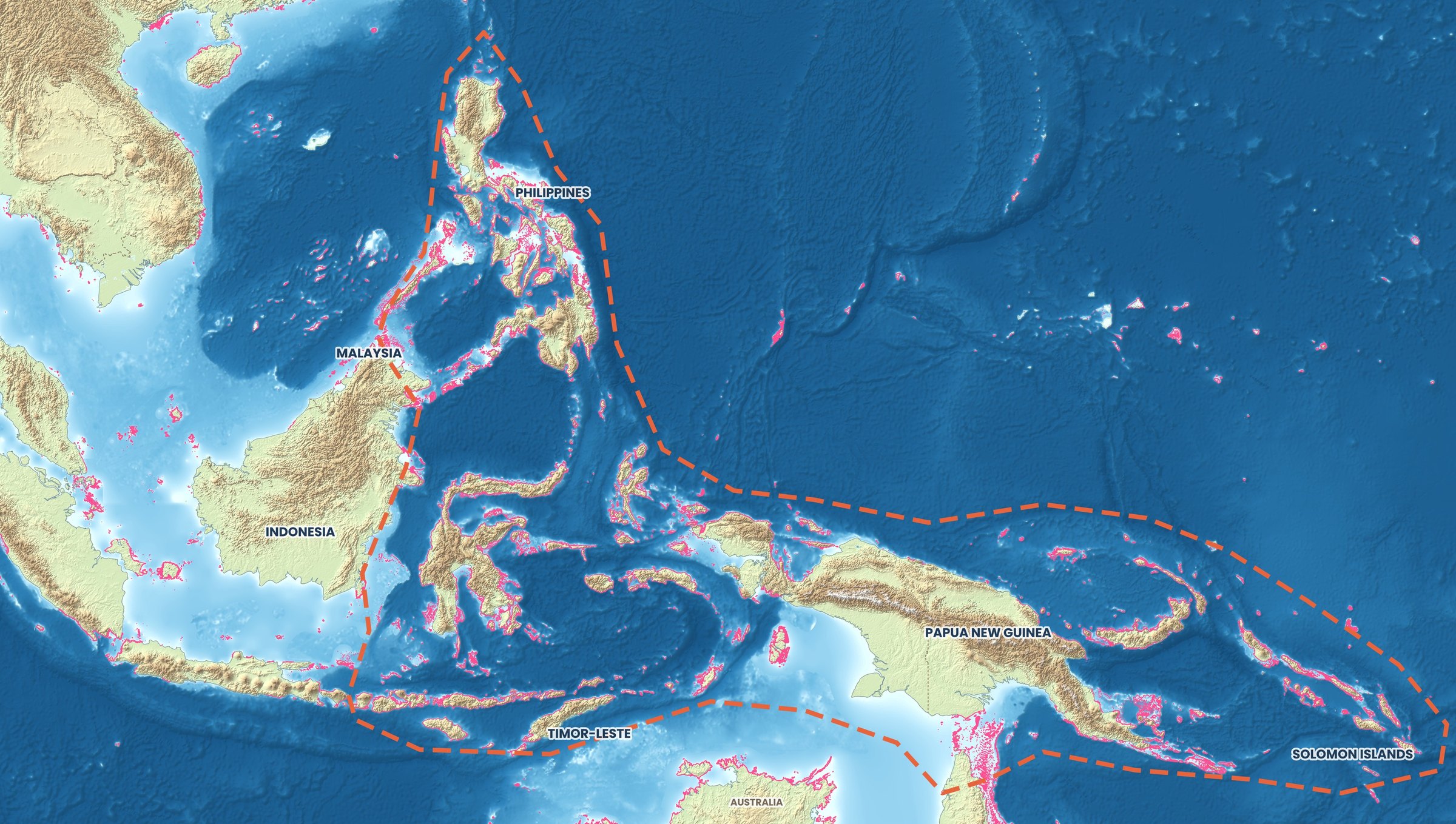
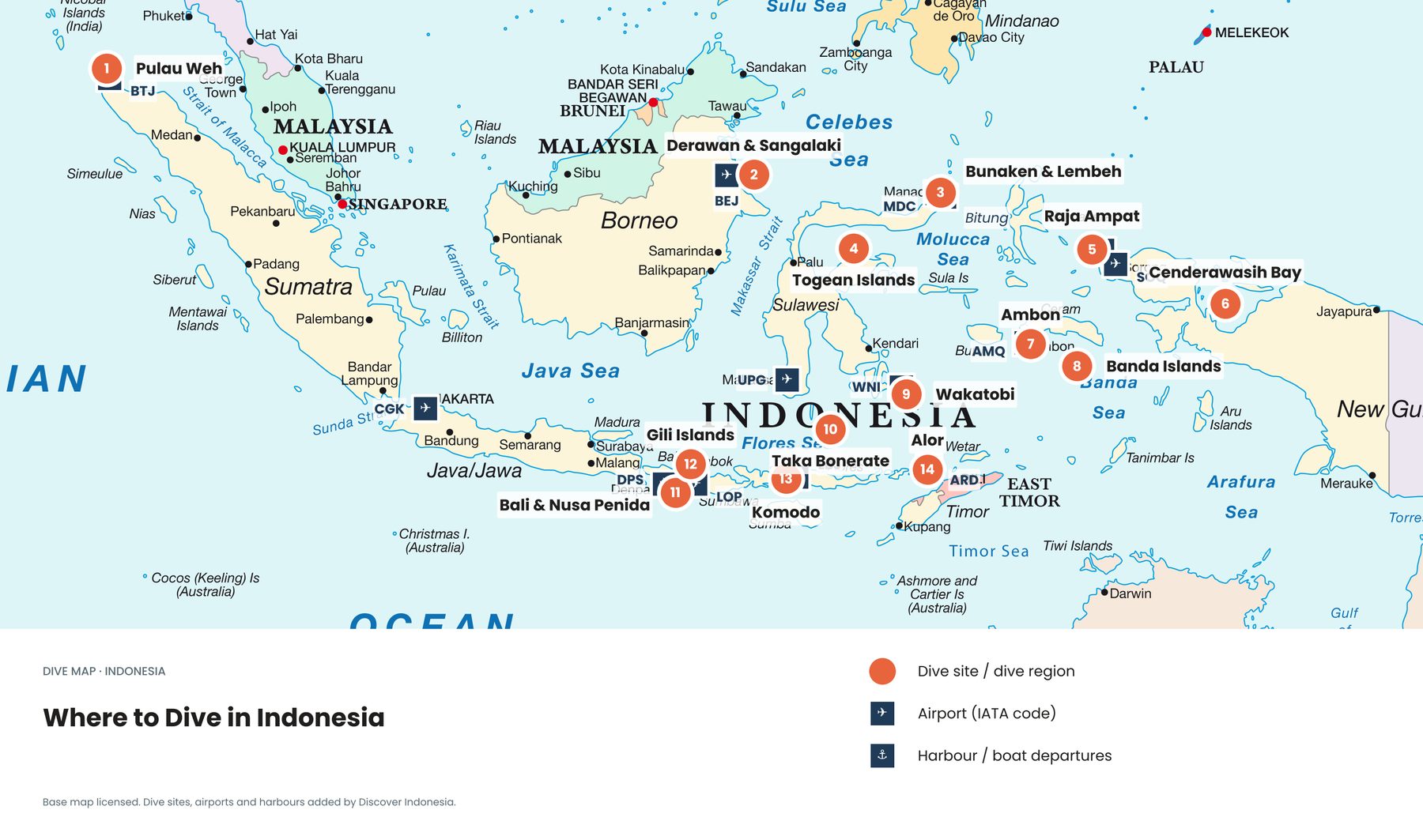
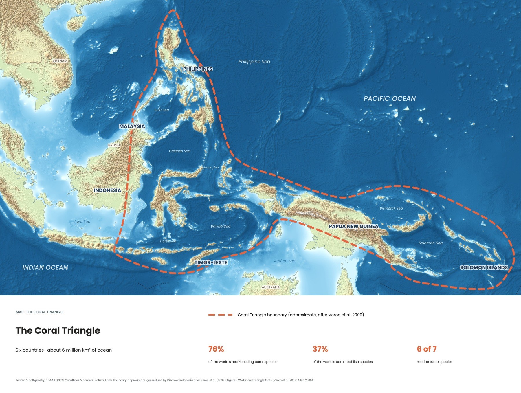
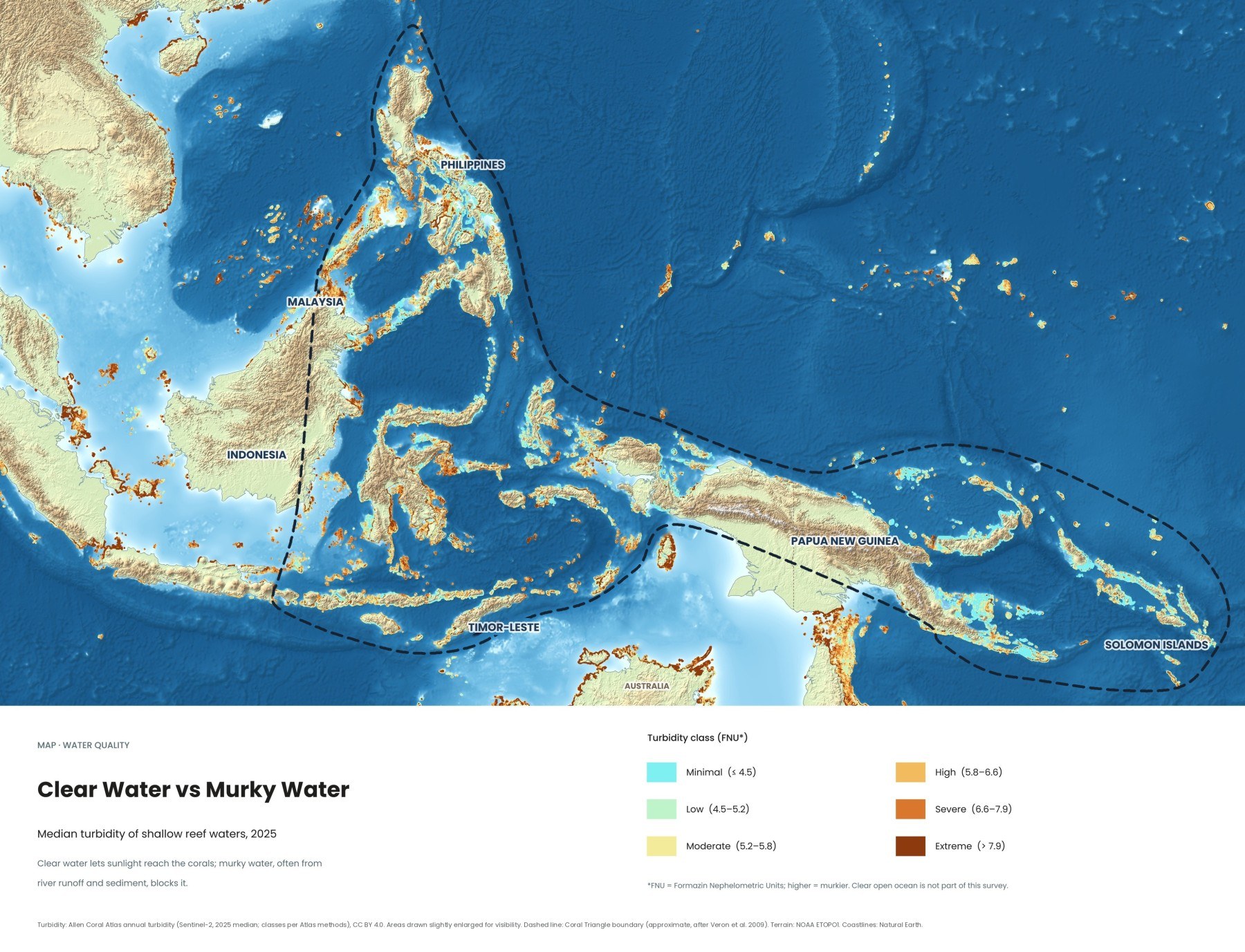
Divers talk about visibility. Corals care about it even more, because they need sunlight to grow. This map shows how clear or murky the water was over every shallow reef in the Coral Triangle in 2025, measured from space, and the guide below explains what drives visibility and when each Indonesian dive region is at its clearest.
Where is the clearest water in Indonesia?
The clearest reef water in Indonesia is usually found around small, remote islands far from big rivers, such as Wakatobi in Southeast Sulawesi, the Banda Sea and Alor. Wakatobi Dive Resort reports visibility of mostly 20 to 50 metres, averaging around 35 metres, because no rivers or lakes carry sediment onto its reefs. On mainland coasts near river mouths and cities, the water is far murkier. Visibility is not fixed, though: it shifts with rain, plankton, upwelling, tides and wind.
How do you read the map?
The map shows turbidity, the cloudiness of the water, over shallow coral reefs: a measure of particles from silt and sand to plankton, by how much light they scatter. The higher the value, the murkier the water.
| Class | Turbidity (FNU) | What it means |
|---|---|---|
| Minimal | 4.5 or less | Clearest water, shown in turquoise |
| Low | 4.5 to 5.2 | Clear |
| Moderate | 5.2 to 5.8 | Some cloudiness |
| High | 5.8 to 6.6 | Murky |
| Severe | 6.6 to 7.9 | Very murky |
| Extreme | Above 7.9 | Heavily clouded, shown in dark brown |
The data come from the Allen Coral Atlas, which processes Sentinel-2 satellite images at 10-metre resolution and takes the median for each pixel across 2025. The classes split the world's reef pixels into sixths, so "high" means murkier than most reefs worldwide, not necessarily bad diving. The map covers the shallow water on top of reefs, not the deep blue off a wall, which is why much of Indonesia shows up orange. The murkiest water sits near large rivers, cities and farmed coasts, such as Sumatra and eastern Borneo.
What controls underwater visibility?
Visibility depends on how many particles float in the water: mainly sediment from land, plankton, and sand stirred up from the bottom.
Rivers and rain. Rain washes soil into rivers, which spread it over nearby reefs as a brown plume. In the Lembeh Strait visibility is usually around 20 metres but can drop to about 4 metres after heavy rain, while at Wakatobi, with no rivers, rain does not affect it. Mangroves and seagrass trap much of this sediment. Why mangroves and seagrass matter for reefs →
Plankton and upwelling. Upwelling brings cold, nutrient-rich water from the deep, which fuels plankton blooms that turn the sea green and hazy. In Indonesia it is closely tied to the Indonesian Throughflow. In southern Komodo upwellings can cool the water to 22 to 24°C, and at Alor to about 20°C. Plankton is a trade-off rather than a problem: it is often exactly where manta rays and schooling fish gather to feed.
Monsoons. Roughly from December to March, the northwest monsoon brings the wet season to most of the southern islands. From roughly May to October, the southeast monsoon brings the dry season to Bali, Lombok, Komodo and the Lesser Sundas, usually with the calmest seas and clearest coastal water. In October 2026, with a strong El Niño under way, NOAA reported suppressed rainfall over Indonesia, which can mean less runoff but brings bleaching risk.
Tides. As a rule of thumb, a rising tide pushes clearer offshore water onto fringing reefs, while a falling tide drains murkier water out of bays and mangroves. Spring tides around full and new moon bring the fiercest currents.
When is visibility best in each Indonesian dive region?
In most of southern Indonesia, from Bali to Komodo and Alor, the dry season from about April or May to October brings the clearest water. Raja Ampat and the Banda Sea are best in roughly October to April and around October to December respectively. Wakatobi is clear all year.
| Region | Clearest, calmest months | Water temperature | Notes |
|---|---|---|---|
| Bali and Nusa Penida | About May to October | Warm, with cold upwellings at Nusa Penida | Mola mola season July to October |
| Komodo (north and centre) | About April to November | 27 to 29°C | Visibility up to about 30 m |
| Komodo (south) | Varies; ask operators | 22 to 24°C in upwellings | Plankton-rich, cooler, manta-rich |
| Raja Ampat | About October to April | 28 to 30°C north, 26 to 28°C Misool | Misool clearest in November and February to March |
| Wakatobi | All year | 25 to 30°C by season | Mostly 20 to 50 m |
| Lembeh Strait | About April to November | 25 to 29°C | About 20 m, much less after rain |
| Alor | About April to October | Can drop to 20 to 24°C | Upwellings at any time of year |
| Banda Sea | About October to December | 26 to 29°C | Around 30 m on good days |
Bali and Nusa Penida. Around Nusa Penida, July to October is mola mola season, when cold upwelling draws the fish up to cleaning stations; the trade-off is chilly water below the thermocline and currents that can change fast. Reef manta rays are present year-round. Our Bali dive site map →
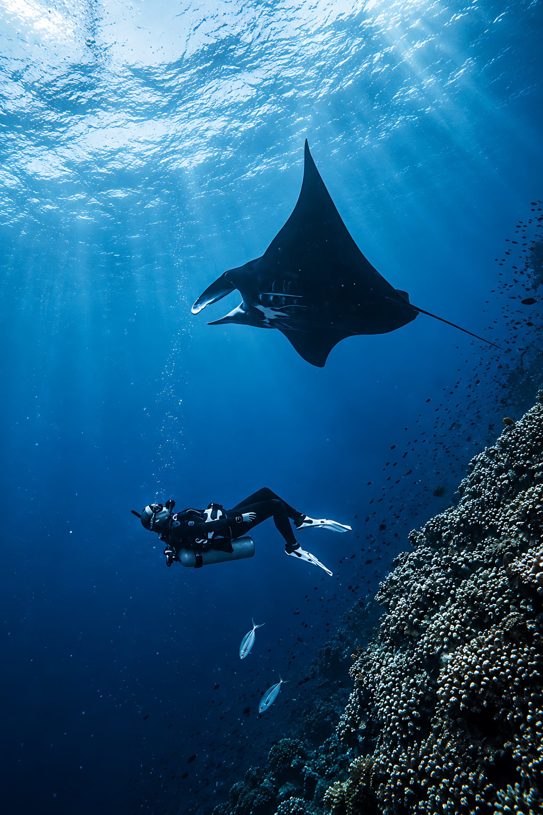
Komodo. The north and centre are clearest in the dry season, while the south, fed by deep upwellings, is often greener and murkier but rich in big animals. Manta encounters often peak from December to February, when visibility is lower, and in January and February the harbour authority in Labuan Bajo can suspend tourist sailings when extreme weather is forecast. Our Komodo dive site map →
Raja Ampat. Most liveaboards run from about October to April, when seas are calmest, with visibility typically 10 to 30 metres. Misool Eco Resort reports rough weather in July, August and early September. September and October bring baitfish and mobula rays, so slightly hazier water can mean more action. Our Raja Ampat dive site map →
Wakatobi is the clearest choice for photographers who cannot pick their dates; the main change is temperature, falling to 25 to 27°C from June to October, when a 5 mm suit is sensible. Our Wakatobi dive site map → In North Sulawesi, the drier months from about April to October or November bring calmer conditions at Lembeh and Bunaken. Our North Sulawesi dive site map →
Alor and the Banda Sea. Alor sits on the Ombai Strait, one of the main exits of the throughflow, and its currents and upwellings keep the water cool and often very clear; pack a thicker suit. Our Alor dive site map → Banda Sea liveaboard trips cluster from roughly September to December, with November often best for calm seas, good visibility and hammerhead sharks.
How can you find the clearest water on your trip?
- Pick the right season for the region, not for Indonesia as a whole. October falls within Raja Ampat's best months and at the very end of Bali's.
- Avoid the day after heavy rain at sites near river mouths or towns. Offshore islands and walls clear faster.
- Ask about tides. Operators in current-swept areas like Alor and Komodo plan dives around slack water, which is safer and often clearer.
- Expect cold where it is clearest. At Nusa Penida, southern Komodo and Alor, bring a 5 mm suit or a hooded vest.
- Keep your fins off the bottom. Good buoyancy keeps the water clear for everyone behind you and protects the reef.
Why does water clarity matter for corals?
Reef-building corals depend on algae in their tissue that need sunlight to make food. Sediment blocks that light and can smother young corals as they settle, so a reef in permanently cloudy water grows more slowly. That makes clarity a land problem as much as a sea problem: keeping forests on hillsides, protecting mangroves and treating wastewater keep sediment and nutrients out of the sea. Where the Coral Triangle's reefs are protected →
Quick answers
Is murky water bad for diving?
Not always. Lembeh's black-sand slopes are famous for frogfish, octopus and nudibranchs, not visibility, and the plankton-rich water of southern Komodo and Nusa Penida brings mantas and mola mola.
When is mola mola season in Bali?
About July to October around Nusa Penida, when cold upwelling draws the fish up to cleaning stations on the reef.
Why is the water so cold at Nusa Penida and Alor?
Upwelling brings cold water up from the deep. At Alor it can drop to about 20°C, against 26 to 30°C on most Indonesian reefs.
Does rain ruin visibility?
Near rivers and towns, yes: Lembeh can drop from about 20 metres to 4 after heavy rain. At Wakatobi, with no rivers, rain does not affect it.
All eight of our free maps are collected in our guide to the Coral Triangle. Our Discover Indonesia diving and Coral Triangle guides go deeper; browse them all on our guides page.
Facts checked October 2026. Visibility and water temperature change with rain, plankton, tides and each year's monsoon and El Niño pattern; ask your dive operator about current conditions before you book and again the day before you dive.
- Methods: turbidity (Allen Coral Atlas, Arizona State University); map data Allen Coral Atlas annual turbidity, Sentinel-2, 2025 median, CC BY 4.0
- Seasons (Wakatobi Dive Resort)
- FAQ (Misool Eco Resort)
- Nusa Penida MPA (Coral Triangle Center)
- Komodo diving (Liveaboard.com)
- Raja Ampat diving (Liveaboard.com)
- Lembeh Strait diving (Liveaboard.com)
- Alor diving (Liveaboard.com)
- Banda Sea diving (Liveaboard.com)
- Diving in Indonesia and Komodo (Divezone)
- Indonesian Throughflow, Raja Ampat Islands and Nusa Penida (Wikipedia)
- ENSO Diagnostic Discussion (NOAA Climate Prediction Center, 8 October 2026)
- Map: boundary approximate, generalised by Discover Indonesia after Veron et al. (2009). Terrain: NOAA ETOPO1. Coastlines: Natural Earth